Carnet / Provence to the Pyrenees
RegionProvence-Alpes-Côte d'Azur and OccitanieBy railTER to Arles, then bus
The Camargue by bus, bike and on foot
A practical route into the Rhône delta, where lagoons, flamingos, semi-wild horses, gardians and salt pans explain the Camargue’s working shape.
 Giles Laurent • BY-SA 4.0
At Arles, the Rhône is not finished with its journey. South of town, its delta spreads between the Grand Rhône and Petit Rhône. You are stepping into a landscape shaped by that division.
The numbers: TER to Arles, then bus.
Arles
Begin in Arles, the gateway to the Camargue. Its Roman amphitheatre still hosts events, giving the town an older gathering place.
Parc naturel régional de Camargue was created in 1970. The Camargue became a UNESCO biosphere reserve in 1977.
Those labels give you two ways to read this landscape. One names a park; the other names a biosphere reserve.
Take TER to Arles, then continue by bus. Keep the plan open for slower sections by bike and on foot.
Think of the bus as your link beyond Arles. Then use walking and cycling as ways to notice the landscape at closer range.
If rail is part of your approach, explore sleeping your way south before reaching Arles. The delta begins south of town.
Read the river names slowly: Grand Rhône and Petit Rhône. Their names mark the delta’s opposing sides. The Camargue lies between them, south of Arles. Keep that shape in mind before choosing how to move.
Start by separating arrival from exploring. TER to Arles, then bus, is the practical sequence. Keep walking and cycling as ways to read the landscape, not just cover distance.
Arles gives you a useful contrast before the delta. Its Roman amphitheatre is still used for events. Then south of town, the river opens into a landscape shaped by its delta.
 Giles Laurent • BY-SA 4.0
Étang de Vaccarès
Give the lagoons their own place in your plan. The Étang de Vaccarès is the Camargue’s largest lagoon.
It covers about 6,500 hectares, so the name carries real scale. Keep that size in mind as you think about the delta.
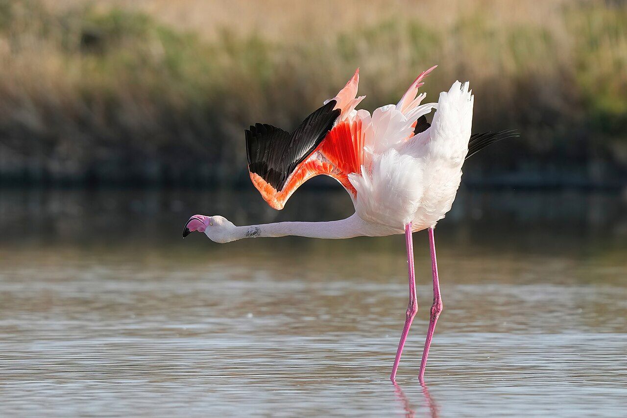
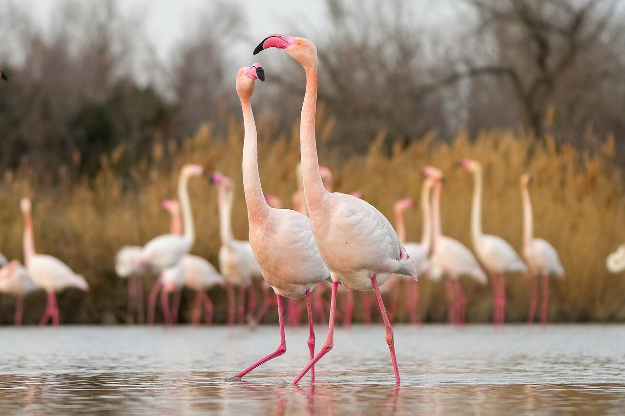
Greater flamingos breed in the Camargue. Their colony is among the few regular breeding colonies on the Mediterranean.
That breeding detail makes the lagoon more than scenery. You are looking at part of a landscape where wildlife reproduces.
The useful trick is to read the Camargue by its different kinds of movement. Water, animals and people give the place distinct rhythms.
Use a bike for the broader shape of your outing. On foot, let each stop become its own small study.
Give the lagoon its own place in your mental map. It is the largest lagoon, not another name for the delta. The distinction helps: rivers describe the delta’s boundary; lagoons give its interior another shape.
In the Camargue, greater flamingos breed in one of the Mediterranean’s few regular colonies. Keep the word breed in view; it says more than simply spotting a bird. This is a landscape with a recurring breeding place.
On foot, ask what the names describe: lagoon, marsh, delta. That small bit of sorting keeps the landscape from becoming a list. On a bike, hold those pieces together across the wider scene.
The useful trick is to read the Camargue by its different kinds of movement.
Saintes-Maries-de-la-Mer
Make Saintes-Maries-de-la-Mer a separate part of the story. The town holds a pilgrimage each May.
Roma and other travellers carry the statue of Saint Sara to the sea. The journey links the town, the statue and the water.
Here, walking is not just a way to cover distance. It lets you follow the pilgrimage’s movement in your mind.
Keep the meaning of the event specific. It is a pilgrimage each May, with a statue carried to the sea.
The Camargue is not only lagoons and animals. This annual act gives its human geography a clear expression.
Leave room in your route for that contrast. River delta, pilgrimage and working landscape belong in the same account.
Keep the pilgrimage as a separate step, rather than scenery. Roma and other travellers carry a statue to the sea. That movement gives Saintes-Maries-de-la-Mer a clear place in your route.
May is not a vague seasonal note here; it is when the pilgrimage happens. Remember the action as well as the month: Saint Sara is carried to the sea.
Aigues-Mortes
Finish at Aigues-Mortes, on the Camargue’s western edge. Its walled form gives the landscape a very different outline.
Louis IX built the town in the 13th century. The walls make that history part of the place’s visible shape.
Salt has been harvested for centuries from pans around Aigues-Mortes. The trade connects the town to the wider delta.
Salin-de-Giraud belongs in the same salt story. Salt has been harvested there for centuries as well.
Set the salt pans beside the lagoons, horses and black bulls. You get a landscape shaped by both natural processes and work.
Black bulls are raised here by gardians, herdsmen on horseback. The white Camargue horse, an ancient breed, lives semi-wild in the marshes.
Let the route end with those contrasts, not a grand summary. A delta, a walled town and salt pans are enough.
Read the walls before the salt pans. Aigues-Mortes stands on the western edge, giving the landscape a clear boundary point.
The town’s construction and salt harvest belong to different time scales. Louis IX built it in the 13th century; harvesting has continued for centuries.
Put Salin-de-Giraud beside Aigues-Mortes in your notes. The same material links these named places across the Camargue.
Then return to the animals: horse and bull are not interchangeable symbols. One ancient breed lives semi-wild; black bulls are raised by gardians.
That is why the working landscape belongs in your route. Salt is harvested, bulls are raised, and the horses live in marshes.
Photos in this piece: Jörg Braukmann • BY-SA 4.0; Benh LIEU SONG • BY-SA 2.0; Hermes from mars • BY-SA 3.0