RegionAuvergne-Rhône-Alpes (Haute-Savoie)By railTrain to Saint-Gervais, then the Mont-Blanc line
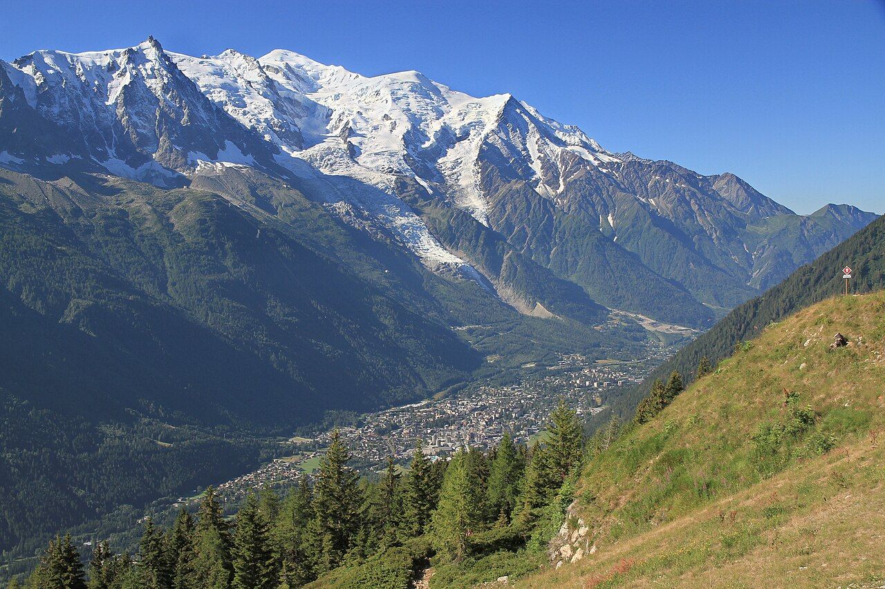
Chamonix beneath Mont Blanc, reached by rail
Ride the Mont-Blanc Express through the valley, take the Montenvers rack railway to the Mer de Glace, then see the Aiguille du Midi and Tour du Mont Blanc.
 Ximonic, Simo Räsänen • BY-SA 3.0
Want to meet Mont Blanc without arriving with climbing gear? Let the trains handle the approach, then choose your altitude. Chamonix sits in a valley at about 1,035 metres, beneath a mountain that rises much higher.
The numbers: Chamonix, about 1,035 metres; Mont Blanc, about 4,805 metres; Aiguille du Midi, about 3,842 metres; Tour du Mont Blanc, about 170 kilometres.
Chamonix
Start with the line that gives this journey its shape. The Mont-Blanc Express runs from Saint-Gervais through Chamonix to Martigny in Switzerland. Chamonix is not a loose collection of mountain viewpoints here. It is a valley on a rail route between two countries. That makes the train more than a way in. It gives you a simple way to understand the wider geography, without needing to walk the whole distance.
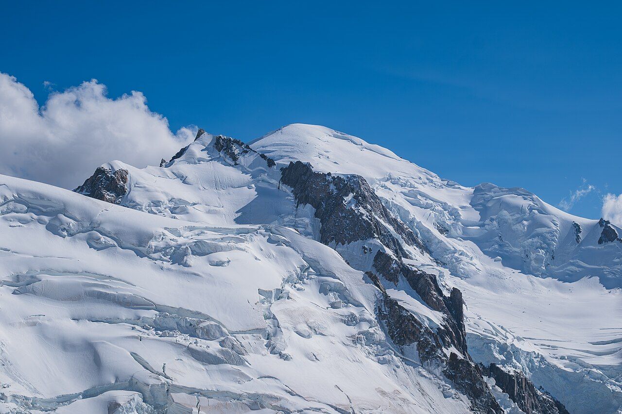
As the train passes through Chamonix, pause on the scale change. The town lies at about 1,035 metres; Mont Blanc stands at about 4,805 metres. The mountain’s height shifts slightly with its snow cap. You have gone from a valley floor to the highest mountain in the Alps, without yet taking a step uphill.
Give the valley a little history before choosing your next ride. Mont Blanc was first climbed in 1786 by Jacques Balmat and Michel-Gabriel Paccard. The first Winter Olympic Games were held in Chamonix in 1924. Those two dates make a neat pair: one marks the mountain’s first climb, the other puts the valley on a sporting map. You can take in that history without treating your visit as a climbing expedition.
For a broader border-crossing frame, the line continues to Martigny in Switzerland. The route also gives you a way to set Chamonix beside the lake city over the Swiss border, without confusing the valley’s rail journey with a walk across the massif.
Now choose the vertical option: the Aiguille du Midi cable car. It rises to about 3,842 metres. That is a precise way to meet the mountain environment without bringing climbing gear. The mechanism is the point: a cable car does the ascent, rather than your legs. You can set this high viewpoint beside the valley’s own elevation and feel the difference in the figures.
Keep the scale in mind. Mont Blanc stands at about 4,805 metres, while the cable car rises to about 3,842 metres. They are not the same height, and the gap is part of the story. I would choose this for the sheer vertical contrast, then leave room for the glacier railway’s very different approach.
Take the Montenvers rack railway for the glacier. It climbs from Chamonix to the Mer de Glace, the longest glacier in France. The rack railway makes the glacier approach part of the story. Instead of treating the journey as a transfer, notice the machinery doing the climbing. It is a wonderfully legible bit of mountain engineering: a railway built to gain height and bring you towards ice.
At the Mer de Glace, the landscape carries a visible measure of change. The glacier has shrunk markedly since the 19th century. Visitors now climb long stairways down to the ice. That descent makes the changed level hard to keep abstract. You meet the glacier through both a railway ride and a staircase, with the steps making the distance to the ice plain.
 Christian David • BY-SA 4.0
The rack railway makes the glacier approach part of the story.
Tour du Mont Blanc
Keep the walking route as a separate kind of encounter. The Tour du Mont Blanc is about 170 kilometres through France, Italy and Switzerland. It is a walking route, not a short add-on to the railway. You can understand its scale from Chamonix, then decide how much walking belongs in your own plan. The important distinction is simple: the train links places; the Tour du Mont Blanc crosses the wider mountain region on foot.
That contrast makes the trip work without climbing gear. You can ride the Mont-Blanc Express through the valley, take the cable car upwards, and use the rack railway to reach the Mer de Glace. The Tour du Mont Blanc gives the walking-minded option its proper scale. I would not pretend that a train ride stands in for that route; they do different jobs.
Notice the other cross-border link, even if your journey stays rail-led. The Mont Blanc Tunnel opened in 1965 and links Chamonix with Courmayeur in Italy. The tunnel and the Mont-Blanc Express tell different stories about connection. One links Chamonix with Italy; the train runs through the valley towards Switzerland. Keep those directions distinct, and the map starts making sense.
You do not need to build a grand circuit around every link. The point is that Chamonix sits among routes, not outside them. The railway gives you a clear line through the valley, while the tunnel and walking route show other ways the massif connects across borders.
Put the visits in an order that lets each mechanism stand out. Begin with the Mont-Blanc Express through Chamonix. Take the Aiguille du Midi cable car for the high ascent. Ride the Montenvers rack railway to the Mer de Glace for the glacier and its stairways. Then consider the Tour du Mont Blanc as a walking route of about 170 kilometres, rather than squeezing it into a rail stop.
This order moves from valley, to cable car, to rack railway, and then to the longer walk. It also avoids pretending that every view comes from the same kind of effort. The valley train, the cable car and the rack railway each explain a different way of reaching the massif.
Chamonix makes mountain access unusually easy to read: line, lift, rack railway, trail. Mont Blanc even shifts slightly in height with its snow cap. The mountain clearly has trouble sitting still for a measurement.
Photos in this piece: Michael.F.H.Barth • BY-SA 4.0; Ylliab Photo • BY-SA 2.0; Giles Laurent • BY-SA 4.0