RegionNormandyBy railTrain to Le Havre, then bus
Étretat: walk the chalk arches of the Alabaster Coast
Walk both cliff tops at Étretat, trace three natural arches, and watch the chalk change in the light, as Monet did in the 1880s.
 Jörg Braukmann • BY-SA 4.0
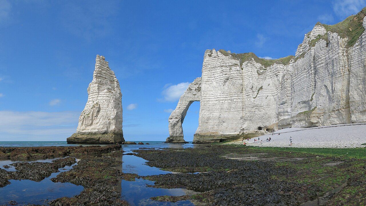
Chalk catches the light above Étretat, then seems to change its mind. From the cliff tops, the arches make the coast feel engineered, though they are natural. Walk both cliffs and watch the colour shift across their white faces. Look out towards the sea, then back towards town.
The numbers: three arches; Monet’s paintings in the 1880s; a memorial dated 1927.
What makes Étretat’s cliffs so legible?
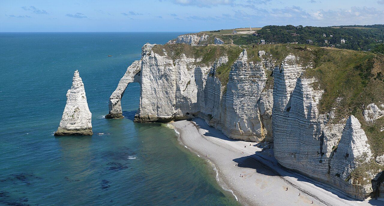
Étretat lies on Normandy’s Alabaster Coast, in the Seine-Maritime department. Its white chalk cliffs form three natural arches: the Porte d’Aval, the Porte d’Amont and the Manneporte. Those names help you keep your bearings as you walk. The formations make a clear sequence, rather than one continuous wall.
At the Porte d’Aval, look for the Aiguille. This tall needle of chalk stands in the sea just offshore. It gives the view another shape to hold onto: arch, needle, open water. The light changes the chalk, but these forms stay easy to pick out.
How should you walk the cliffs?
Give the eastern and western cliff tops their own stretches. From above, you can see the arches from different angles, and watch the chalk change as the light shifts. The GR21 long-distance footpath follows the cliff tops of the Alabaster Coast. That larger route gives your walk a name and a wider frame.
Keep the pace unhurried enough to look back. The point is not simply to collect three arches. Notice how the sea, the chalk and the changing light rearrange the same view. You get a different reading of the coast from each cliff top, without needing a complicated plan.
Why did Monet keep returning?
 Jörg Braukmann • BY-SA 4.0
Claude Monet painted the cliffs of Étretat dozens of times in the 1880s. That is a useful nudge to look again, rather than decide you have seen the scene already. Watch where the light falls across the chalk, then how the shapes read from another point along the cliffs. You are not trying to reproduce a painting. You are noticing why one view could hold attention repeatedly.
The cliffs also make a good lesson in naming. Porte d’Aval, Porte d’Amont and Manneporte are not interchangeable labels. Learn them as separate arches, and the coastline becomes easier to read as you move along it. Add the Aiguille beside the Porte d’Aval, and you have a small, memorable map.
What else belongs on the walk?
On the Falaise d’Amont, above town, stands the chapel of Notre-Dame-de-la-Garde. A memorial there marks where the aviators Nungesser and Coli were last seen in 1927, trying to fly the Atlantic. Both give the cliff top more than a view: one is a chapel above town, the other a marker tied to an attempted crossing.
Keep these stops in the walk without letting them crowd out the coast. The chalk remains the main event; the chapel and memorial help you notice how people have used this exposed edge. The Falaise d’Amont gives you both landmarks above the town.
What should you expect beside the water?
The beach at Étretat is made of flint pebbles rather than sand. That changes the texture underfoot, and makes the beach another expression of the coast’s materials. If you are thinking beyond Étretat, the Normandy coastline also points towards the landing beaches further west.
For this walk, though, stay with the chalk. Take in the three arches, find the Aiguille, and give both cliff tops time. Monet returned to these cliffs dozens of times. You can at least look twice.
Photos in this piece: Myrabella • BY-SA 3.0; Jacquym • BY-SA 4.0; Gzen92 • BY-SA 4.0