RegionNormandyBy railTrain from Paris Saint-Lazare to Bayeux
The D-Day beaches of Normandy, one section at a time
A slow route links five landing beaches from Bayeux, by public bus and on foot. Give the cemeteries, harbour remains and Pointe du Hoc room to register.
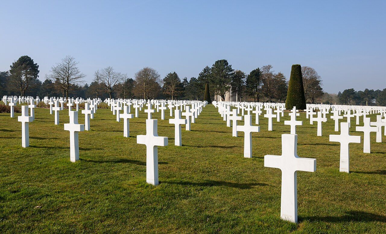 Myrabella • BY-SA 3.0
The coast does not ask to be understood in one sweep. From Bayeux, let the journey take shape in sections. Each beach carries a code name, and each stop changes the view. You are following about 80 kilometres between the Cotentin peninsula and the mouth of the Orne.
The numbers: five beaches; about 80 kilometres; two or three days.
Use public buses between sections, then walk where you stop. A train from Paris Saint-Lazare reaches Bayeux. Keep the route slow, rather than turning every landmark into a quick tick. The point is to see how the names, coast and memorials fit together.
Bayeux
Start in Bayeux, the first sizeable town in France liberated. That happened on 7 June 1944, the day after the landings. It makes a useful base for thinking through the coast’s geography. The Bayeux War Cemetery is the largest Commonwealth cemetery of the Second World War in France.
Give the cemetery its own pause before setting out. It shifts the story from a line of beach names to individual graves. Then plan your first section towards Sainte-Mère-Église. Keep the next stretch flexible: you are arranging a sequence, not racing between points.
Sainte-Mère-Église
Begin the coastal story at Sainte-Mère-Église, one of the first towns liberated. American paratroopers liberated it in the early hours of 6 June 1944. Place that detail before the beach names, and the route’s shape becomes clearer. The landings were not a single moment on one shore.
On 6 June 1944, Allied forces landed on five beaches. Their code names were Utah, Omaha, Gold, Juno and Sword. Take those names as the route’s basic framework. They keep the long coast legible, even when the places begin to blend together.
From here, work towards Utah and Pointe du Hoc. Use the bus for the longer links, and walking for the ground around each stop. The exact shape of the day can follow the sections you choose. Don’t cram every name into one rushed pass.
Utah and Pointe du Hoc
Utah gives you one end of the landing sequence. Pointe du Hoc stands between Utah and Omaha, on a clifftop. US Army Rangers scaled it on D-Day. Its position makes the coast’s geography unusually easy to read: this is a point between two named beaches, not an isolated stop.
Give Pointe du Hoc time before moving on. The clifftop setting is part of the fact, not an extra flourish. Look at the relationship between the point and the beaches. Then carry that map in your head towards Omaha.
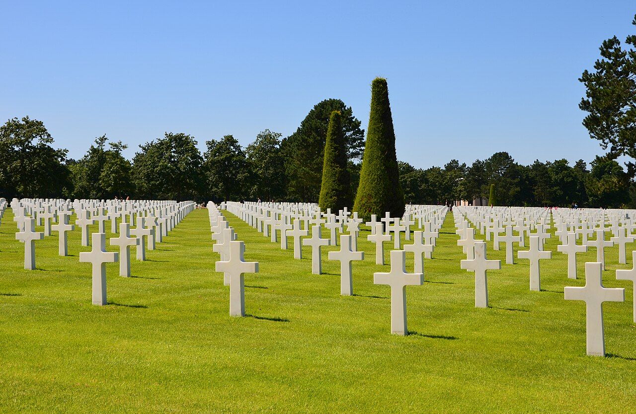 Gzzz • BY-SA 3.0
Set Monet's chalk arches aside for another route; here, follow the landing names from point to point.
Omaha
At Omaha, put the cemetery into the same section. The Normandy American Cemetery at Colleville-sur-Mer holds more than 9,300 American service members’ graves. That number changes the pace of a visit. Give the cemetery room, rather than treating it as another marker beside the road.
Keep the landing beach and cemetery together in your thinking. One names the stretch of coast; the other holds the graves. The route is easier to follow when you notice those different kinds of remembrance. Skip extra destinations here.
Keep the landing beach and cemetery together in your thinking.
Arromanches and Gold
Continue towards Arromanches and Gold. The remains of the Mulberry harbour built by the Allies can still be seen in the sea off Arromanches. Here, the coast carries evidence of a structure made for the landings. Look out to sea, and the harbour becomes part of the route’s story.
Keep this section distinct from the cemetery visit. At Arromanches, the focus shifts from graves to the remains of a harbour. That change is useful: the coast is not one repeated memorial scene. Its landmarks explain different parts of the same operation.
Juno and Sword
Make Juno the next section. The Juno Beach Centre at Courseulles-sur-Mer tells the story of the Canadian landing. Its subject gives the beach a clear place in your sequence. Keep Juno separate from the American sites in your notes; the names are not interchangeable.
Finish at Sword, the final name in this route. You have moved from Sainte-Mère-Église through Utah, Omaha, Gold and Juno. Sword closes the sequence without requiring you to hurry through every stop. The coast stretches between the Cotentin peninsula and the mouth of the Orne, so two or three days suit a slower approach.
Commemorations are held along the beaches each year around 6 June. If your route meets that period, it becomes part of a living calendar. Otherwise, the sequence still holds: town, beach, clifftop, cemetery, harbour and centre. Take one section at a time, and let the names do their work.
Photos in this piece: Jacquym • BY-SA 4.0; Gzen92 • BY-SA 4.0; PIERRE ANDRE LECLERCQ • BY-SA 4.0