RegionBrittanyBy railTGV from Paris Montparnasse, about 2 h 30
Saint-Malo: the ramparts at high and low tide
A high-tide circuit, a low-tide return, and the workings of a port shaped by corsairs, rebuilding and the sea.
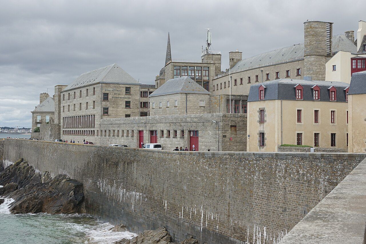 Gzen92 • BY-SA 4.0
The tide is high, and Saint-Malo seems to hold its breath.
The numbers: ramparts, about 2 kilometres; tidal range, up to about 13 metres; TGV from Paris Montparnasse, about two hours and thirty minutes.
Where does the walk begin?
Saint-Malo is a walled port on Brittany’s Emerald Coast, at the mouth of the Rance. The old town is called intra-muros, meaning within the walls. Walk its ramparts for about 2 kilometres, with the sea setting a different scene at each tide. This is a circuit worth reading twice: once with the tide high, then again when it falls.
What are the walls telling you?
Saint-Malo was a base for corsairs: privateers licensed by the king to attack enemy shipping. That licence matters. A corsair was not simply a pirate with a better story; the king’s permission made the distinction. The port’s history also travelled outward. Jacques Cartier was born here and sailed up the Saint Lawrence in 1535, towards the city Cartier's voyages led to.
What changes at low tide?
When the tide falls, a sand route opens to Grand Bé. The island is where the writer Chateaubriand is buried. At high tide, that crossing is not available. So the same walk gives you two different arrangements: walls and water, then sand and an island. The tide is not just scenery here; it changes which ground connects.
Is the old town entirely old?
No. About 80 per cent of Saint-Malo’s old town was destroyed in August 1944. It was rebuilt in the following decades. Keep that in mind as you walk: intra-muros carries both the shape of a historic port and the record of a much later rebuilding.
What else explains the water?
The Rance tidal power station spans the estuary between Saint-Malo and Dinard. It opened in 1966. The powerful tides here are not merely a detail for the ramparts walk; they also drive infrastructure across the estuary.
How do you make the two walks work?
Take the ramparts as your constant, then let the tide change the rest. At low tide, add the crossing to Grand Bé. At high tide, leave the sand crossing out and keep to the walls. The distinction is simple, and that is the pleasure: one port, two versions of the same shoreline.
Photos in this piece: PIERRE ANDRE LECLERCQ • BY-SA 4.0; Carsten Steger • BY-SA 4.0; TCY • BY-SA 4.0