RegionBrittanyBy railTGV to Saint-Malo, Lannion or Brest
The GR34: three Brittany stages, not the whole coast
The old customs path runs almost the length of Brittany. Pick the Pink Granite Coast, Cap Fréhel or Crozon, then let morning, midday and late afternoon shape your walk.
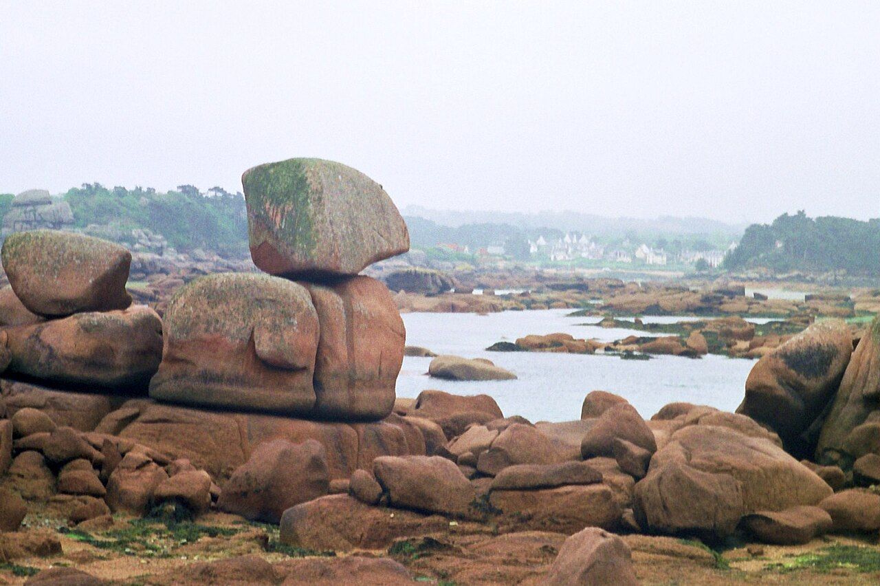 PIERRE ANDRE LECLERCQ • BY-SA 4.0
Why walk almost 2,000 kilometres when three shorter choices explain the coast? The GR34 follows almost the whole coast of Brittany, from Mont-Saint-Michel to the Loire estuary near Saint-Nazaire. The numbers: about 2,000 kilometres, and a path once watched for smugglers.
The GR34 grew from the sentier des douaniers, where customs officers patrolled against smuggling. Today, red and white stripes mark it, like other French GR footpaths. In 2018, the national hiking federation’s public vote named it the French favourite long-distance footpath.
Use the time of day as a walking rhythm, not a clock. These are separate stretch choices, not one ambitious day. Walk a linear stage between towns, then use regional buses to split the route. TGV trains reach Saint-Malo, Lannion or Brest.
The clever move is to walk a stretch, not the whole coast.
The clever move is to walk a stretch, not the whole coast.
Pink Granite Coast
Morning. Start with the Pink Granite Coast around Ploumanac'h. It is one of the GR34’s best-known stretches, which makes it an easy place to understand the path’s appeal. The name gives you the basic clue: granite, and a coast shaped around it.
Keep the plan simple. Choose a linear section rather than trying to collect the whole coast. Walk one way, then make the return part of your transport plan. Walkers often divide the GR34 into day stages between towns linked by regional buses.
Midday. Follow the red and white waymarks, and let the path do its job. The route’s long scale can tempt you into thinking bigger is automatically better. It isn’t. A single stretch gives you time to notice how the coast changes underfoot, without turning the day into a distance contest.
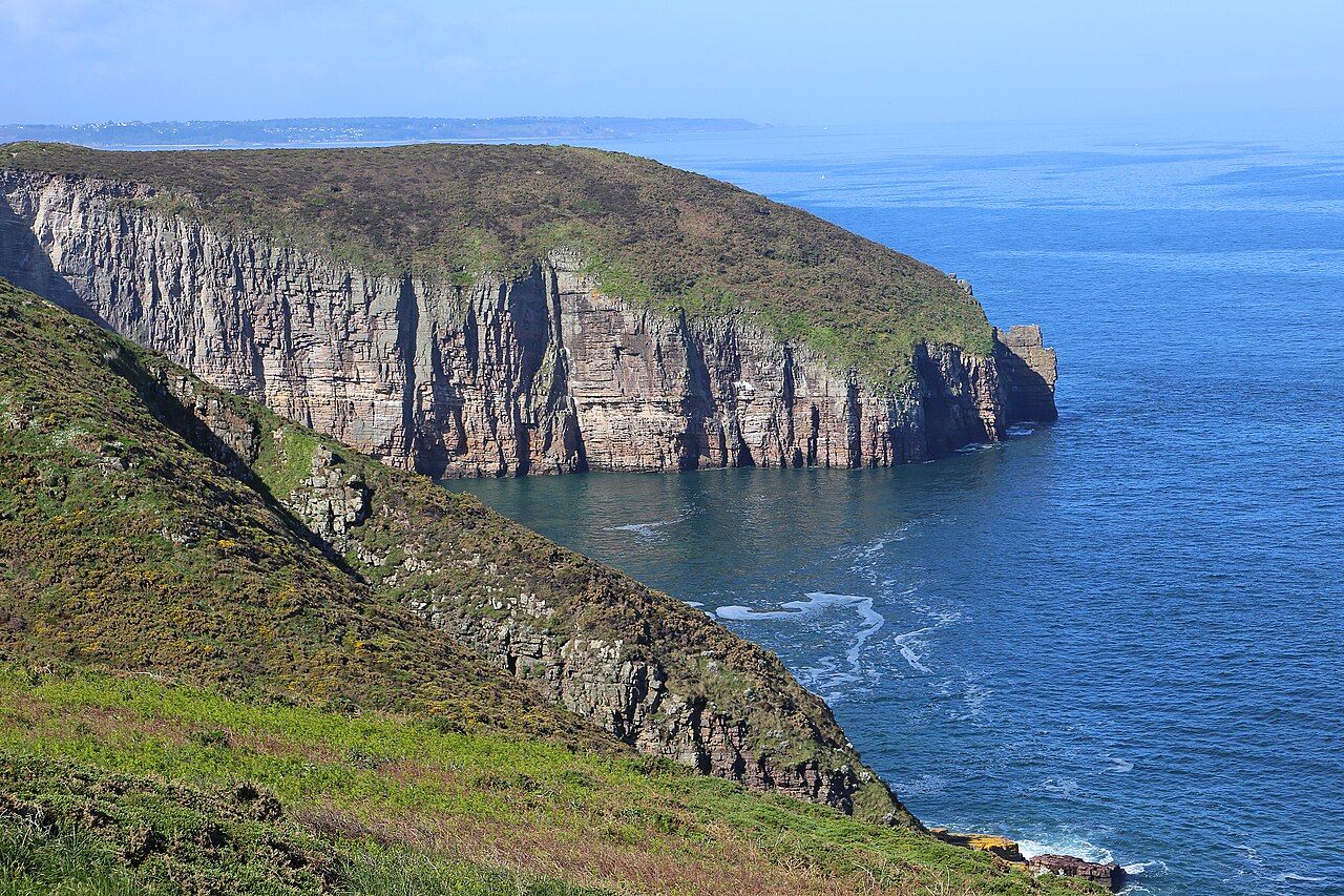 W. Bulach • BY-SA 4.0
If old lines interest you, see the Neolithic stone rows of Morbihan. Keep that as a separate idea, rather than folding another destination into this walking stage.
Late afternoon. Finish at your chosen town connection, rather than adding miles for the sake of it. The regional-bus links are what make short linear stages practical. You get a clear beginning and end, not the awkward business of retracing every step.
Cap Fréhel
Morning. Make Cap Fréhel your next independent stage choice. The lighthouse stands above heath of gorse and heather on the Emerald Coast. That gives this stretch a different emphasis: open heath, a lighthouse, and the coast beneath.
Keep your walking plan centred on the headland. The lighthouse is the anchor in the landscape, not a reason to invent a grand circuit. Choose a line that fits the day, then use the path’s waymarks to keep following the GR34.
Midday. Pause over the route’s old job. Customs officers once watched these coasts for smugglers, and their sentier des douaniers became the GR34. You are walking a path whose purpose changed, while its coastal line still gives the journey shape.
The red and white stripes are a useful bit of route language. They belong to French GR footpaths generally, not just this one. Read them as your thread through the walk, rather than treating the whole 2,000 kilometres as one task.
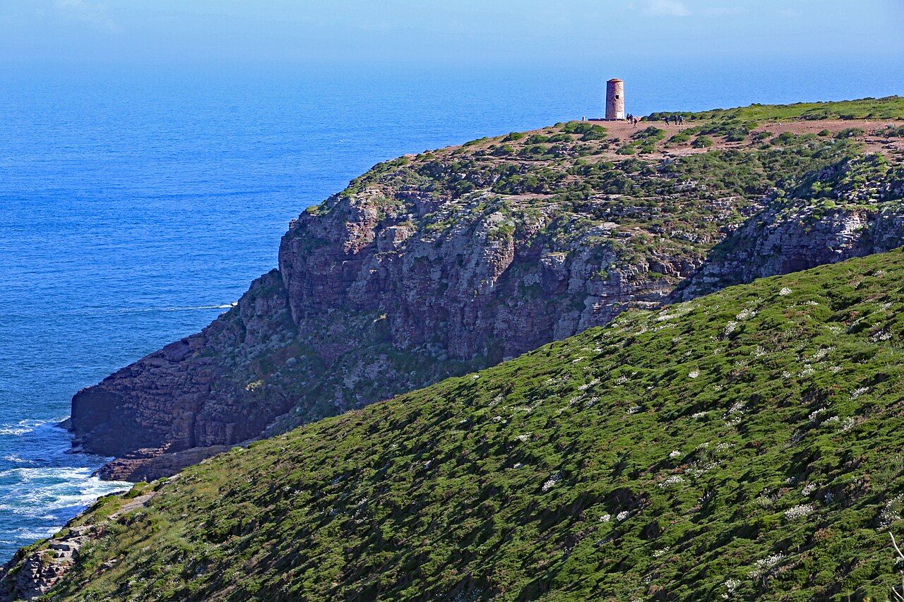 W. Bulach • BY-SA 4.0
Late afternoon. End the stage in a town linked by regional buses. The point is choosing a manageable section with a transport connection, not pretending every part of the coast works as one tidy day. Skip the urge to turn a good walk into a walking exam.
Crozon
Morning. On the Crozon peninsula, the GR34 passes Pointe de Pen-Hir. The cliffs there rise about 70 metres. That is the clearest reason to choose this stretch: the headland gives the coast a strong vertical edge.
Build the day around one linear section. Crozon is a stretch to select on its own, not the next stop in a same-day dash from Cap Fréhel. Keep the towns-and-buses approach in mind, and let the route length stay sensible.
Midday. At Pointe de Pen-Hir, take in the scale of those cliffs. The figure is about 70 metres, but the useful detail is the change in shape: the path meets a high edge above the sea. The GR34 is not just a line on a map; its setting keeps changing.
Late afternoon. Finish your chosen stage without chasing the route’s full length. Almost the whole Brittany coast is already enough ambition for one path. The public vote in 2018 tells you French walkers liked it; it does not require you to walk every kilometre.
Pick the granite, the heath or the high cliffs. Use the stripes, split the walk between towns, and leave the rest for another stage. The customs officers chased smugglers; your only pursuit is the bus.
Photos in this piece: Carsten Steger • BY-SA 4.0; TCY • BY-SA 4.0; Raimond Spekking • BY-SA 4.0